Ornox – Geographic Information System

XONT – Ornox GIS


Ornox GIS

Map your way to better business decisions

Ornox Geoware the cost effective Business GIS tool that doesn’t expect you to be a cartographer to take advantage of the power of Mapping software. Ornox Geoware the cost effective Business GIS tool that doesn’t expect you to be a cartographer to take advantage of the power of Mapping software.

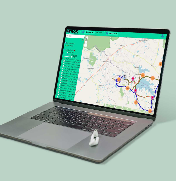
Ornox Geoware is an enterprise offering that utilizes a map enabled portal to present corporate data as meaningful information. Ornox Geoware provides a configurable foundation to control access to data and functions at the user level, integrate with other corporate applications, utilizing existing investments in systems, data and training. X-ONT Geoware is an offering developed on Webserver Open Source platform. It combines the power of an Enterprise class web server location-based technology with the flexibility of the Java development environment.

Ornox Geoware is a premier business tool that uses the power of the internet to unleash the Intelligence of geography, demographic data, consumer lifestyles combined with the power of corporate business data.

Intelligent business decision making

It is a viable asset for intelligent business decision making. By analyzing business spatial data in comparison to the geographies such information originated from companies can visually discover  trends, patterns and opportunities hidden in traditional reports. By combining information such as sales data, stock data, customer information, competitor data;  with geographic data such as demographics, territories or distributor areas, state, provinces or districts Ornox Geoware helps you better understand your markets your customers and your competition.

X-ONT Geoware  is uncomplicated and easy to understand, enabling employees who ever they may be to work more efficiently by displaying the map, legend and attribute information on one screen. The availability of this information to all employees regardless of their GIS skills will ensure that spatial information will be available to all within a company and not limited to technical users only. Information is made available visually as company data as well as other geopolitical layered and displayed on one screen.